
We just had the midterms. What’s happening in your district right now? Who’s leading in the race?
Every election night, millions of Americans look at the results as they’re coming in. But what do blind voters, campaigners, and political enthusiasts do? How do you understand, use, and learn from maps when you’re blind, visually impaired, or have a print disability?
Brandon Biggs is a PhD candidate and CEO of XR Navigation who’s on a mission to change the accessibility of maps, and even the playing field for those who are blind, visually impaired, or have a print disability on election night!
In 2024, Brandon and the XR Navigation team released the first-ever accessible live election results map, and his team is back in 2026 with a map you can see, hear, touch and read! The fully accessible map covers local, primary, general and state races.
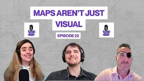
Join Brandon Biggs, Tanner, and Ellie on Episode 22 of the WCATea Podcast to talk map accessibility, navigation, AI, robotics, and his favorite apple juice in the Italian Alps!
Check out accessible voting maps here → 2026 Election Result Map
Who Is Brandon Biggs, CEO of XR Navigation?
Before he was building maps, Brandon was singing on stage, studying abroad in Italy and Malta, and publishing research that’s now been cited more than 100 times on Google Scholar.
Here’s the plot twist… XR Navigation is his second company. His first, Sonja Biggs Educational Services, which he started with his mom, brings visually impaired programs to K-12 schools around the country.
Did you know that blind people view less than one map a year, while sighted people view more than 300, and about 20% of all people, including many with dyslexia, color blindness or autism, can’t use maps in their current form?
We charted the five biggest insights from Brandon’s conversation. Fair warning: number five might change how you think about AI.
First stop… election night.
1. Can Blind People Follow Election Results on an Accessible Map?
Yes! XR Navigation’s 2026 election map lets you see, hear, touch or read election results. No need to sit on the sidelines while everyone else talks about red and blue states.
- It covers local, primary, general and state races.
- New users should take the short Audiom tutorial first.
- Have another map you want in Audiom? Brandon’s team will add it. Email info@xrnavigation.io.
2. What Is Audiom, and How Does It Make Maps Accessible?
Audiom is a digital map that everyone can use, whether they explore by sight, sound or touch.
- Sight: You can zoom to 200% and click things to hear them read aloud.
- Sound: You move with arrow keys and hear street and building names, like in a video game.
- Touch: It works on full-page braille displays like the Monarch and Dot Pad, and with tactile graphics that Audiom reads aloud as you touch them.
- It’s been tested in 13 academic studies with more than 150 blind and 40 sighted participants.
3. Why Isn’t GPS Enough for Blind Navigation?
GPS tells you where to turn, but it doesn’t show you the big picture and the last few feet can’t be triangulated by GPS accurately enough to find the door, even though you know you’re on location.
- Mobility gets you from point A to point B. Apps like BlindSquare do this.
- Orientation tells you where you are, so you can find your way back when you get lost. Maps do this.
- Brandon says confident navigation needs four things: a mental model of the area, signage, maps and turn-by-turn directions.
4. What Does WCAG 1.1.1 Require for Digital Maps?
If information is on the visual map, it has to be in the text version too. This comes from WCAG 1.1.1, Non-text Content.
- That includes shape, size, distance, direction and labels.
5. Can AI Make Maps Accessible for Blind Users?
Partly. AI’s good, but not that good yet. Audiom’s AI map chat gets about 80% of answers right, double the roughly 40% other tools score on existing benchmarks.
- AI is great when you already know what to ask.
- Exploring the map yourself shows you things you didn’t know to ask about, like a shoe store around the corner.
Does ADA Title II Require Accessible Maps?
Yes. Cities, counties, state agencies, universities, colleges, and K-12 schools are covered by ADA Title II, which means maps, websites, apps and PDFs need to meet WCAG 2.1 AA. Our certified testers with disabilities find what’s broken and show your team how to fix it.
Get a Title II accessibility audit →
Smaller project? Testing by certified testers with disabilities starts at $800. Book user testing
Buying new software? Brandon’s advice: ask for an accessibility conformance report (ACR) before you sign. Every failed item becomes a cost you pay later. Train your procurement team to spot broken products before you buy →
Are PDFs Covered Under ADA Title II?
Yes. Title II covers PDFs too, from GIS maps to CIP contracts, meeting minutes to course curriculum, assignments, and handouts. DARTDemand combines a remediation engine with certified experts, so you can clear the backlog without hiring a whole team.
See how DARTDemand works!
Wondering how your website measures up? Request your free Accessibility Report.
How Does Intuit Handle Digital Accessibility? Watch Episode 20
How does accessibility work at a company used by millions? Ken Bigler, who leads accessibility engineering at Intuit, explains how his team pairs AI-powered fixes with real users with disabilities.
Read: AI, Digital Accessibility + World Traveling with Ken Bigler
Watch: Ken Bigler’s Podcast Interview Episode 20!
Where Can I Learn More About Accessible Maps?
- Visit XR Navigation →
- Want a map added to Audiom? Email info@xrnavigation.io
- Want to test your GIS maps with trained, certified US-based experts? Book time with a consultant.
Where Can I Listen to the WCATea Podcast?
- Follow the WCATea Podcast on Apple Podcasts or Spotify
- Subscribe on YouTube
- Follow us on LinkedIn, Facebook, Instagram
- Did you know we’re syndicated? Catch WCATea on Mind’s Eye Radio every Wednesday at 6 PM Central